
 Contact


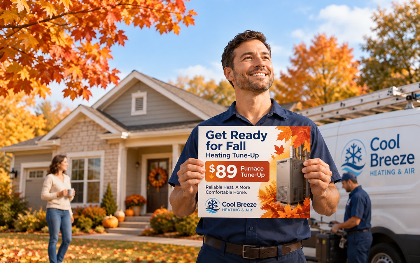
Pick the neighborhoods where you want customers, such as the streets you already serve.
Choose NeighborhoodsStep-by-step, with the real screens, below.
In short
- Search a ZIP code.
- Review the neighborhoods and counts.
- Select the neighborhoods that belong in this campaign.
- Review the total mailing quantity and price.
- Repeat with another ZIP if you need more neighborhoods.
If you want help making the choice, campaign planning is free.
Watch it done
The real Route Picker, recorded: a search, a route preview, three routes selected, and the same selection in the table. 31 seconds, no sound. Captions available.
Read what happens in the recording
- Type a ZIP code, or several separated by commas, then choose Search Routes.
- Every carrier route found appears on the map, and the count says how many.
- Hover a route to preview its address count and demographics.
- Click the route to select it. Click it again to remove it.
- The bar at the bottom adds up the routes, the mailing quantity and the estimated price.
- The Table view shows the same selection, with each route’s numbers side by side.
- When the selection looks right, continue to your campaign.
Counts and prices in the screen are an example; yours are calculated live.
Before you start
- The area: a ZIP code, several ZIP codes, or an address to search around.
- Choose whether the postcard reaches residential homes only, or homes and businesses.
- You can search and select routes without signing in.
Step by step
Step 1: Search the area
Type a ZIP code in Search location. For more than one, separate them with commas; one search covers up to 25. To search around an address instead, type the address and pick a distance from 1 to 5 miles. Then choose Search Routes.
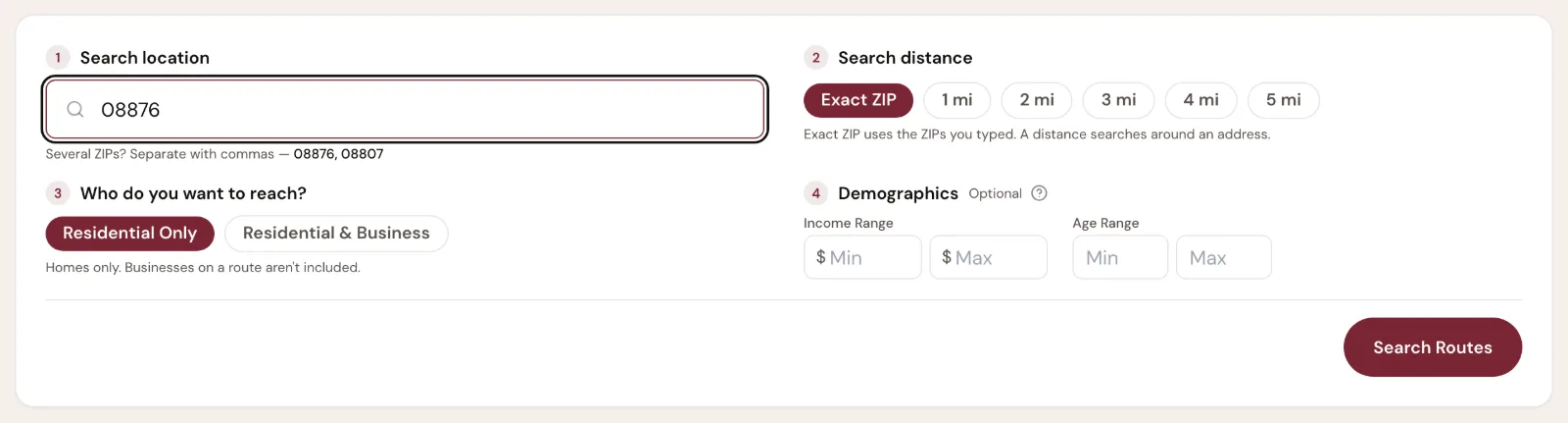
- A: Search location: a ZIP code, several ZIPs, or an address
- B: Search Routes runs the search
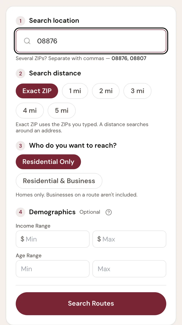
- A: Search location
- B: Search Routes
Settings 2 to 4 on the card are optional. Who do you want to reach chooses homes only or homes and businesses; Demographics narrows the routes shown by income and age.Counts and prices in the screen are an example; yours are calculated live. What you should see. A count of the routes found. See them on a map, or as a table.
Step 2: Look over the routes
Each line on the map is one route, the area a letter carrier covers. The count says how many routes the search found and, if you set income or age ranges, how many they filtered out. Switch between Map and Table at any time.
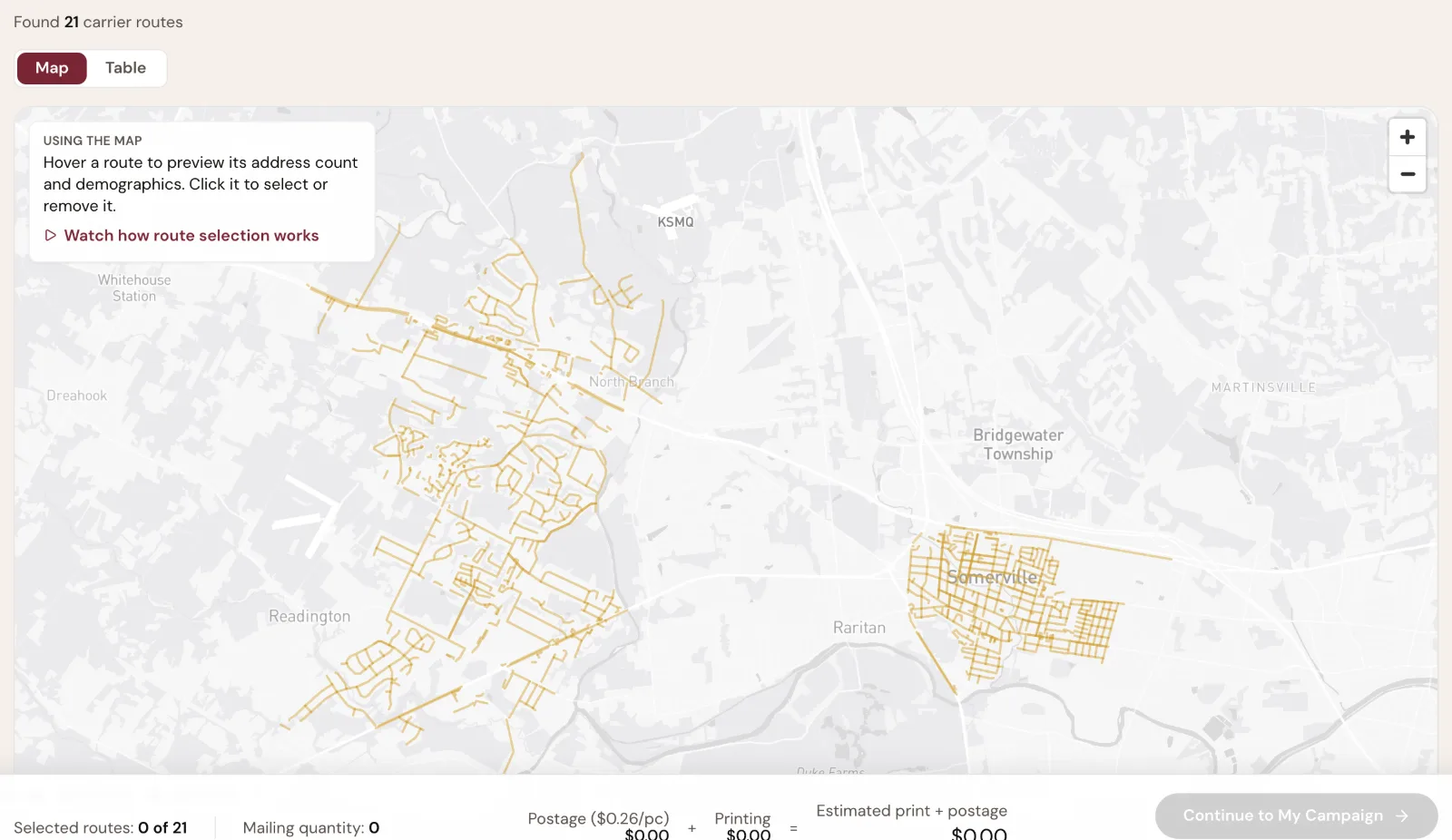
- A: How many routes the search found
- B: See the routes on a map, or as a table
- C: How to use the map, with a short recording
- D: Gold is available, wine is selected
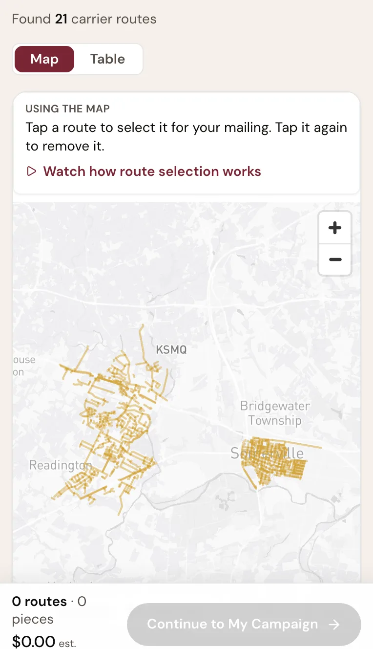
- A: How many routes the search found
- B: Map and Table
Counts and prices in the screen are an example; yours are calculated live. Step 3: Preview a route
Point at a route to see how many homes and businesses it reaches, with its median income and median age. On a phone, the same details sit under each route in the list.
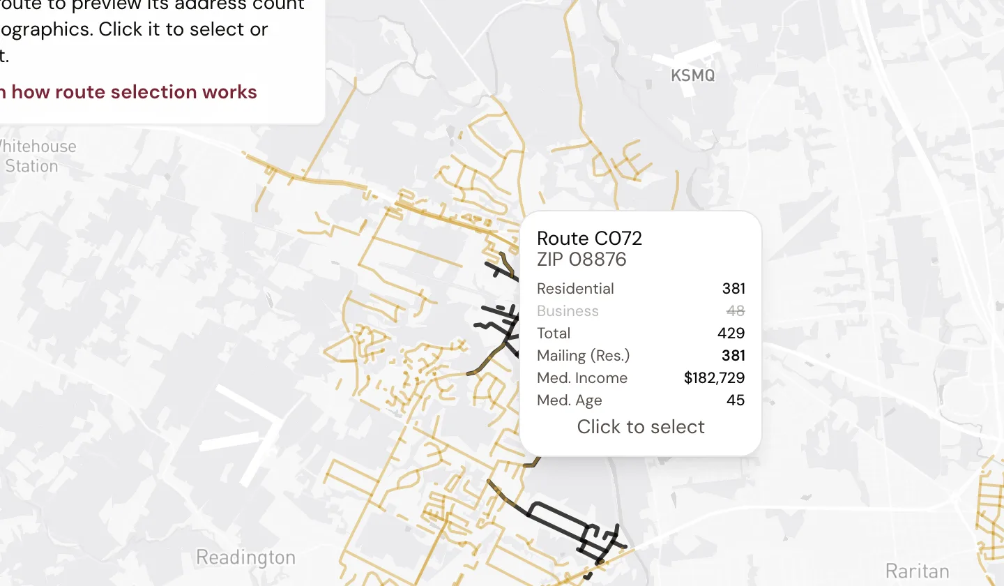
- A: The route under the pointer is highlighted
- B: Its counts and demographics
Counts and prices in the screen are an example; yours are calculated live. Step 4: Select routes
Click a route on the map, or tick it in the table, to select it. Click or untick it again to remove it. The map and the table show the same selection. Filtering changes both together, so a route you cannot see in the table is not silently still in your order.
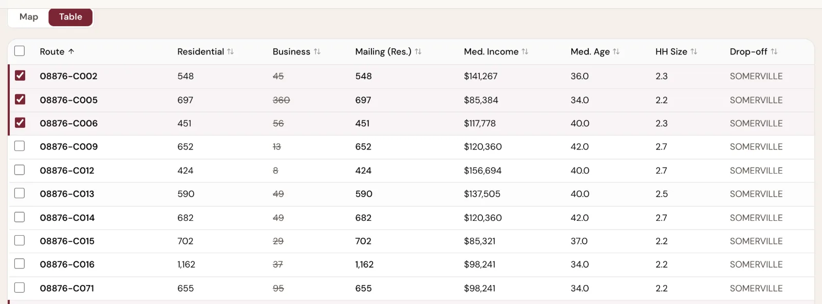
- A: Table view
- B: The count each route adds to the mailing
- C: Median income and age from USPS route data
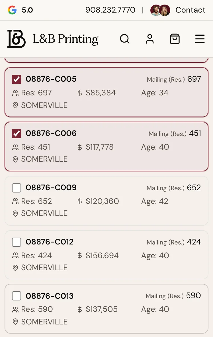
Counts and prices in the screen are an example; yours are calculated live. What you should see. Selected routes turn wine on the map, and the bar at the bottom of the screen adds them up.
Step 5: Check the quantity and the estimate
The bar adds up what you selected: the routes, the mailing quantity, postage and printing, and the estimated total. The mailing quantity comes from the selected routes’ address counts. A note under the bar (under Price details on a phone) explains which printing tier applies.

- A: Routes selected
- B: Mailing quantity
- C: Estimated print + postage
- D: Continue to My Campaign
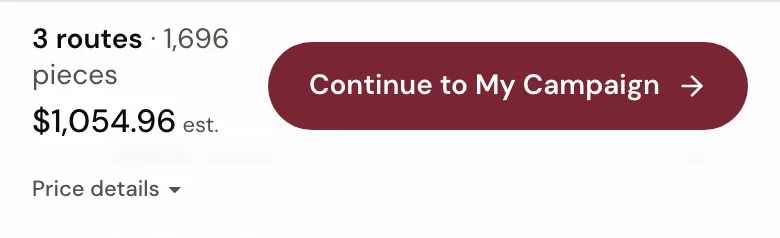
- A: Continue to My Campaign
Counts and prices in the screen are an example; yours are calculated live. What you should see. The quantity and estimate change as soon as you add or remove a route.
Step 6: Optional: skip specific addresses
Under the route list, open Skip specific addresses to list addresses that should not get the postcard, such as your own. Type the number and street; the routes supply the rest. Up to 22 per ZIP.
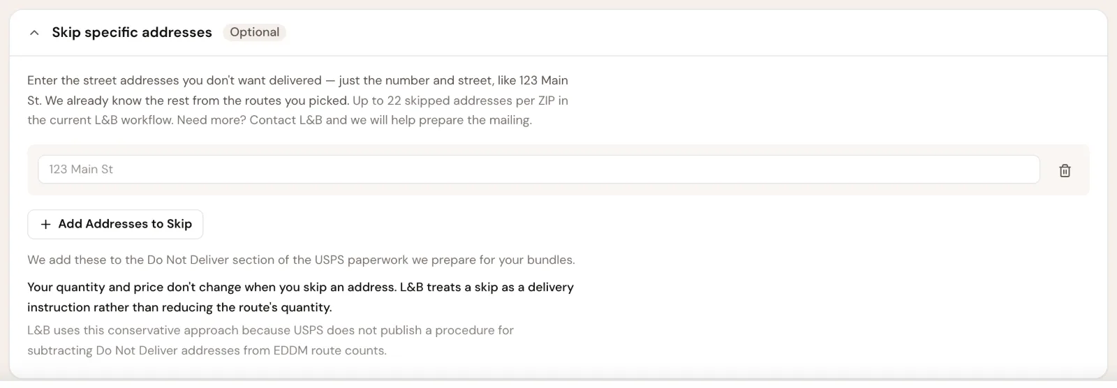
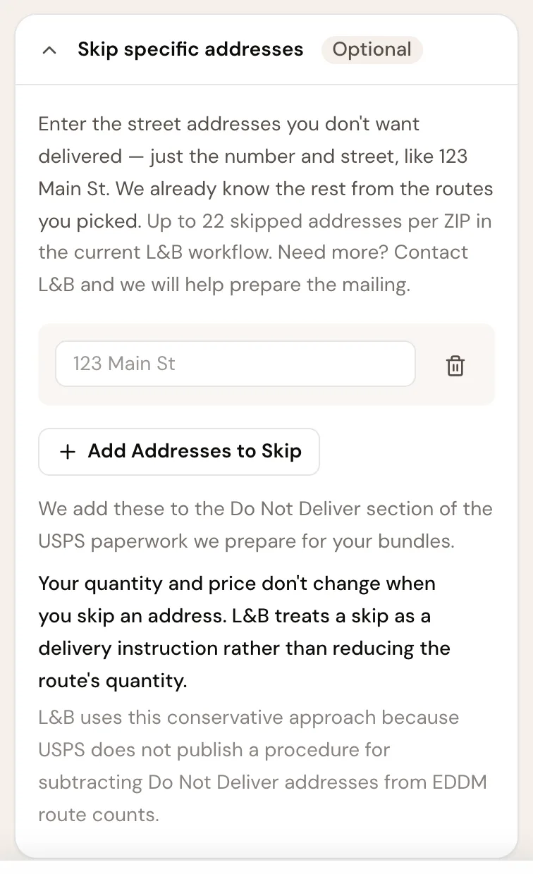
Counts and prices in the screen are an example; yours are calculated live. Step 7: Continue to your campaign
Select Choose Your Design, then how the postcard gets designed: Customize a Design, Upload My Design, or Have L&B Design It. If you came to the Route Picker with a design or your own artwork, the button names that next step instead, such as Customize This Design, Review & Approve Design or Add to Cart.

- A: Design it online
- B: Upload my artwork
- C: Have L&B design it
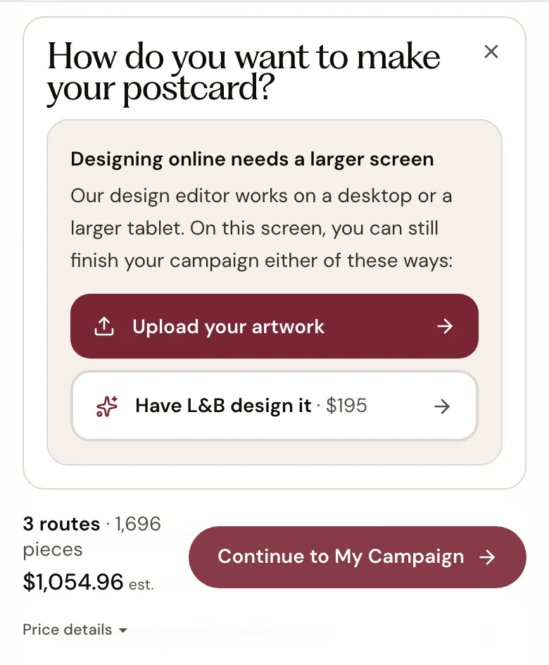
Counts and prices in the screen are an example; yours are calculated live. What you should see. Your routes and mailing quantity carry into the campaign. Nothing is charged until you pay at checkout.
If something goes wrong
“We couldn’t find eligible routes”
Try a nearby ZIP code, or search a distance around an address. Or call L&B and we will pull the routes for you.
“Route data is not available right now”
Choose Try Again. If it keeps happening, contact L&B for help building the mailing.
The route map will not load or is stuckOnly the first 25 ZIP codes were searched
One search covers 25 ZIP codes. Search the others separately, or plan a larger mailing with L&B.
Fewer routes than you expected
Residential Only leaves out routes that deliver only to businesses, and income or age ranges hide routes outside them. Change those settings; the count shows how many routes were filtered out.
The bar says the mailing needs more pieces
USPS needs at least 200 pieces for EDDM. Add neighborhoods until the bar reaches it; the button stays unavailable until then.
“Demographic estimates are temporarily unavailable”
You can still choose routes and continue. Income and age ranges do not narrow the routes while the estimates are missing.
The map does not show
Use the Table view. It lists the same routes and keeps the same selection.
An address count changed
Counts come from USPS route data and can change when that data changes.
Why did my route count change?Next
- Choose NeighborhoodsSearch an area and pick routes.
- Plan with an Expert — FreeHelp choosing the area, before you buy anything.